5 Incredible Gorge Walks in Karijini National Park

 Image courtesy of Laurie Boyle via flickr
5 Gorges to Visit in Karijini National Park
It’s hard to choose but here are five of the best gorge walks in Karijini.Joffre Gorge
Joffre Gorge was quite the introduction to Karijini National Park. After setting up the camper trailers, Joffre Gorge was a short walk past the termite mounds in Karijini Eco Retreat. The late afternoon sun hit the far wall and lit up the gorge as we peered over the cliff. Half our party scrambled down into the natural amphitheatre of Joffre with its island of crushed rock. Most of the walk is a Class Four but a section towards the bottom becomes a more challenging Class Five. There are slabs of rock and narrow ledges need negotiating along the pool. Follow the arrows to lead you the safest way down.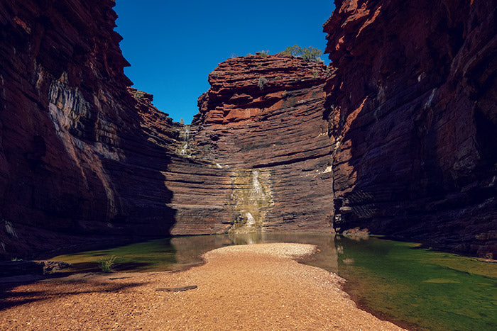 Image courtesy of Graeme Churchard via flickr
Hancock Gorge
Hancock Gorge is one of the most photographed gorges in the park. The allure of Kermit’s pool, small falls and narrow passes make for a rewarding and spectacular hike but also one of the most difficult. It is best left to those walkers who have a high level of fitness and experience. From the edge of the gorge, you follow a series of metal ladders to the gorge floor. After wading through cold pools, you need to clamber along rock ledges and stony creek beds. The gorge then narrows to a point where the only way through is to spider walk with arms and legs straddling the gap to move along the walls. Check out Kermits Pool and prepare to head back.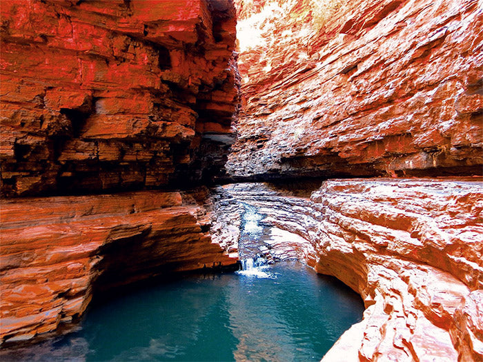 Image courtesy of Bob Tarr via Wikimedia Commons
Dales Gorge
Dales Gorge is popular with three main attractions to enjoy including Circular Pool, Fern Pool and Fortescue Falls. We started at Fortescue Falls taking the short but steep walk from the carpark. The spring-fed waterfall is the only permanent one in the national park and offers a big pool often in the sun for swimming. After walking down the falls and on to the other side away from the carpark, we took the trail to Circular Pool. The 2 km walk had changing flora and plenty of fauna to check out. There were steps along rocks and over gaps that kept the walk interesting. They describe circular Pool as vertigo-inducing because its walls are so high. As hot as we were after the walk, the shaded pool water was cold and only half of the party ventured in for a dip. A series of steep stairs from Circular Pool takes you to the top of the gorge and a walk back to the car.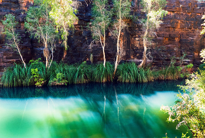 Image courtesy of Paulkyranc via Wikimedia Commons
Weano Gorge
We were keen to check out Handrail Pool so we set off on a leisurely walk from the start of Weano Gorge. As the gorge narrows its Class 3 status changes to a Class 5. We walked along ledges and over rocks as far as we could before taking off our shoes to wade through the cold water to reach Handrail Pool. Some people change into booties to wade through but it’s possible to walk in bare feet over the pebbles and rocks. We didn’t go past the handrail before wading back through the water. Rather than hiking all the way back we took the steep stairs to the top of the gorge.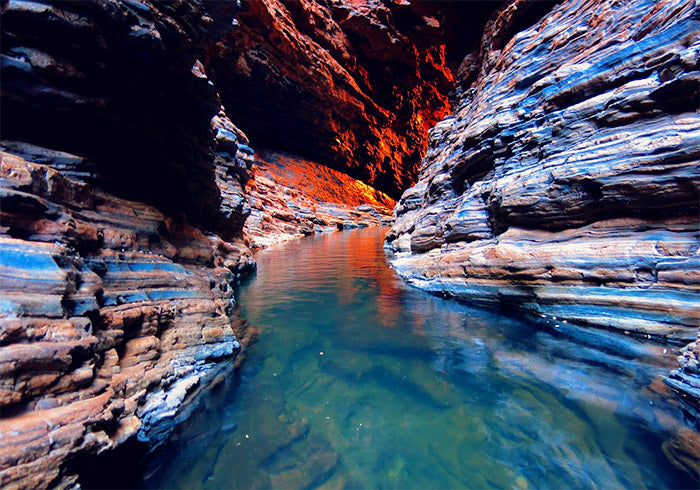 Image courtesy of Bob Tarr via Wikimedia Commons
Knox Gorge
One of the more challenging trails in Karijini, Knox Gorge requires some fitness to scramble over rocks and walk along ledges. After leaving the car park, head to the lookout then down into the gorge. To the right is a swimming hole surrounded by paperbark trees and to the left is the start of your adventure. The basin starts out wide and then narrows to ledges on either side of the wall. Look out for the fig trees that grow from the gorge walls. At one point the trail does a 90 degree turn to the right and the trail becomes a narrow ledge that needs negotiating with your feet and hands.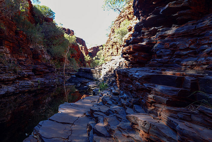 Image courtesy of Graeme Churchard via flickr
Handy Information About Karijini National Park
Looking for information about what’s available in Karijini and how to stay safe?Accommodation at Karijini
There are two campsites within Karijini – Dales Gorge Campground and Karijini Eco Retreat. Dales Gorge Campground has a quiet camping area and one that allows limited use of your generator. There are bush toilets and barbeques but no showers.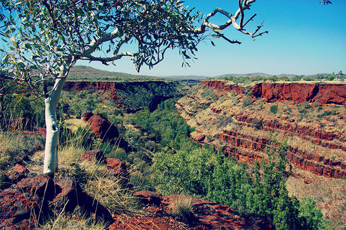 Image courtesy of Gypsy Denise via Wikimedia Commons
Karijini Road Conditions
There is a western and eastern entrance to Karijini National Park. From Tom Price, the western Bajima Drive is closest to Karijini Eco Retreat, the Hancock and Weano Gorges. From Newman the eastern entrance is closest to Dales Gorge and campground.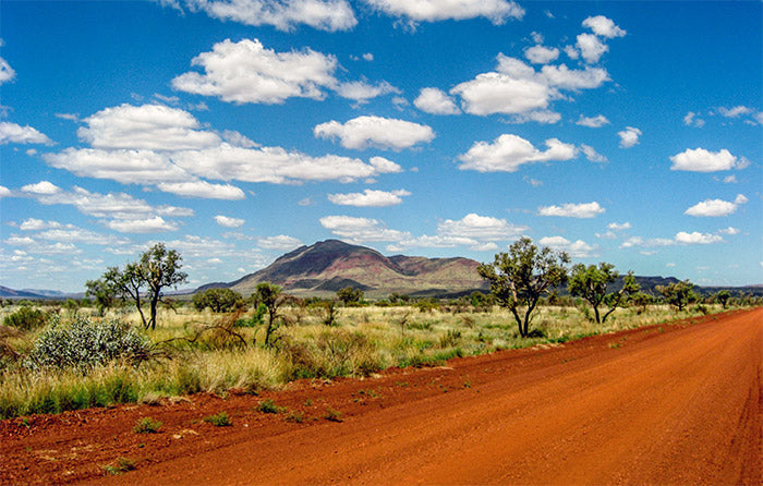 Image courtesy of Tehani Schroeder via flickr
Staying Safe in Karijini
Karijini has a tragic past. Serious injuries and deaths have occurred from falls, ledge collapses, flash flooding, snake bites and heat exhaustion. Karijini is remote and rescues take hours to mobilise. If you are walking anywhere remote in the park or on your own, tell someone what time you expect to return. Mobile phone coverage is not available. Even the water in the gorges poses a risk. Some pools are so far down they don’t see the sun. If you are there in winter, the water can cause hypothermia so don’t jump or dive straight in. If it rains, leave the gorge. Image courtesy of Phil Whitehouse via Wikimedia Commons
Karijini with Kids
There were some reservations about taking our 3-year-old son. While we knew he wouldn’t run off and would hold our hand, there is the risk of the adult slipping. I did some research and emailed a Karijini ranger who responded with handy information about the gorges and their classes. Sometimes the gap was too wide for a 3-year-old to jump across and the dads had to pass him along. Fortunately, there were no injuries to anyone in our party of 14... if you don’t count the adult who tripped on the tent opening one night. Image courtesy of Phil Whitehouse via Wikimedia Commons
More Information
Before you head off, pick up a copy of the Karijini National Park Topographic Map which has a satellite image of the map area on the reverse. The image shows roads, buildings, mining infrastructure, dams and points of interest – everything a tourist would want to know about the area. Want to read up on the rocks? Check out Geology and Landforms of the Pilbara for information on the geology and evolution of the Pilbara region. If you are looking for any maps, charts or guides on the Pilbara region, give us a call on (08) 9335 8665 or contact us online and we can give you a recommendation or track down your request.Featured collection
Categories:
Australia
News
Travel
Posted on: May 16, 2019


Comments