The Birdsville Track - A Guide to Driving One of Australia’s Most Iconic Routes
 The Birdsville Track is an old stock route that dates back to the 1860s. It was used to move cattle from Queensland down to Maree in South Australia. Today the track sees livestock trucks and a steady stream of tourists keen to see a precious piece of the Australian outback. The original stock route is the ‘inside track’ and only suitable during dry conditions. The ‘outside track’ is only slightly longer and more reliable.
Birdsville Track Facts
Location: Birdsville to Maree (Maree is in the north-east of South Australia and Birdsville, is in the south-west of Queensland) Track Length: 517 km Road Conditions: Stony track with large pebbles (gibbers) and dry sand. Conditions change depending on weather and the time since it was last graded. Suitable For: A 4WD is recommended for driving the Birdsville Track, but 2WD with good clearance can be suitable. Fuel Availability: Mungerannie Roadhouse is about halfway along the track and has diesel and unleaded petrol. There are no other fuel stops on the track. Tyres and minor car repairs are also available. Camping Availability: Birdsville Caravan Park, Clayton Station, Maree Caravan and Campers Park, bush camps. Driving Time: 10 hours Best Time of the Year: May to September to miss the summer heat Permits: None required What to See/Do: Lake Harry ruins, sunrise on the Birdsville Billabong, Burke & Wills Tree and drive up the Big Red sand dune. Phone & Data Coverage: Extremely Spotty to non existent in across stretches of the track. It's highly recommended that you carry a two way radio, GPS, and maps in case of emergency. Image courtesy of Geoffrey Rhodes via flickr
Camping & Accommodation Along the Track
With the races attracting thousands to the area each September, you have plenty of accommodation spots to choose from other times of the year. There are hotels, motels, caravan parks with cabins and bush campsites to choose from. The famous Birdsville Hotel has motel accommodation, a caravan park with units, cabins and an area for tents and caravans. You can camp right on the stunning Birdsville Billabong inside the caravan park or there are free camps outside town over the bridge that crosses the Diamantina River. If you need firewood, collect it well before town as there is none available for 5km around Birdsville. Image courtesy of Summerdrought via Wikimedia Commons
Some Helpful Hints and Tips for Campsites Along the Birdsville Track
- Tippipila Bush Camp has a toilet and basin.
- Mungerannie Roadhouse has cabins with shared bathroom facilities available.
- Cooper Creek campsite has a toilet and drinking water and allows you to camp within a 1km radius of the toilet. There are other locations around Cooper Creek that allow camping.
- The Coolibah Camp at Dulkianna Station provides travellers with a shower, toilet and camp kitchen.
- Clayton Station has its own outdoor spa bath fed by artesian waters, that some suggest have therapeutic qualities. Others just think it’s a good way to cool off.
- Maree marks the end of the track. If you are looking for a little more luxurious digs than the bush campsites, there’s a roadhouse, a hotel and two caravan parks.
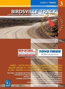 Another helpful hint is to grab a copy of the Birdsville Track Outback Travellers Guide (RRP $22) which has all the information you need to make your way from one end to the other. Birdsville Track Outback Traveller's Guide
Food, Water & Supplies
Because the track is remote, it’s safest to take all the food and water you will need while travelling. The Birdsville Roadhouse has basic grocery supplies and the Birdsville Bakery is almost as famous as the town’s hotel. Spoil yourself after a few days of meals cooked in the bush campsite. The Wirrarri Visitor Centre in Birdsville has all the souvenirs you could want to take home to friends and family.Things to See & Do along the Birdsville Track
For such a far-flung, sparsely populated location, there’s no shortage of things to see around Birdsville. Image courtesy of Haydyn Bromley via flickr
Burke and Wills Tree
The Burke and Wills Tree are said to be one of the last camping locations of Robert O’Hara Burke and William John Wills, before they reached their final destination of the Innamincka area. In 1860 the men made the trek from Melbourne to chart a course to the Gulf of Carpentaria. They died on the return journey. The tree is three kilometres from Birdsville.Birdsville Billabong
Located on the edge of a desert, the billabong is an oasis that provides much-appreciated water activities. Cool off with a swim, canoe or kayak. Pelican Point offers views of the billabong and birdlife. Visit late in the day and stay for a stunning sunset. If you're a bird lover, we highly recommend grabbing a copy of 100 Australian Birds (RRP $30), so that you can easily identify all the amazing birdlife you'll come across. 100 Australian BirdsBirdsville Events
If you’re in the area in early September, be sure to check out the famous Birdsville Races. Punters have been betting on horse races since 1882. They hold the Big Red Bash in July at the base of the Big Red dune. The event attracts boot scooters and music fans from all over the country. Around 6,000 people camp and park their vehicles to create an impressive desert amphitheatre formation best viewed from the air.Munga-Thirri National Park
If you are a 4WD enthusiast, there are plenty of tracks to lead you through the one million hectare park. Because of extreme summer heat, the National Park closes between December and March. Its most famous attraction is the Big Red, a 40-metre tall sand dune. Climb up on foot or by 4WD to boogie board down or take in the sunset from the tallest dune in the park.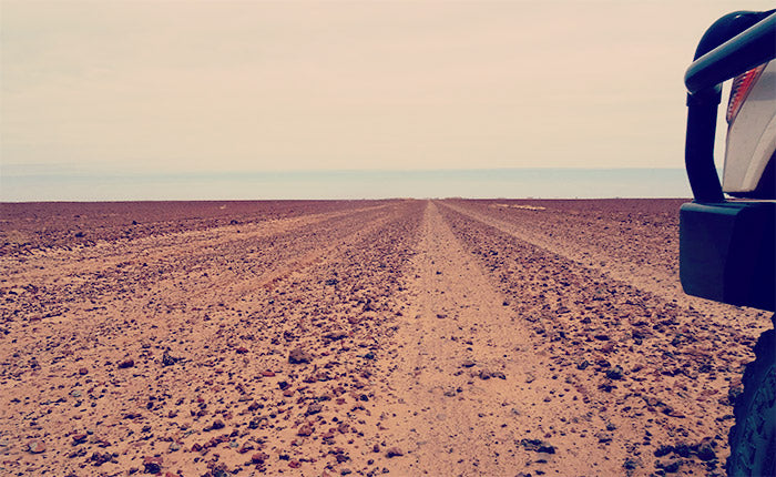 Image courtesy of Ian Cochrane via Wikimedia Commons
Birdsville Track Road Conditions and Road Closures
The Birdsville Track’s condition can change quickly. While there isn’t a lot of rain to contend with out here, when it arrives it can play havoc with the roads. Closures can occur any time so stay informed by phoning or visiting road condition websites. The track and surrounding roads might not close but may be open only to 4WD’s not towing. You can find current road conditions and travel information from the following sites: South Australian Outback Roads Queensland Road Condition Report Diamantina Shire Council Road Conditions ReportWhere Eat and Drink Along the Birdsville Track
Birdsville is famous for its races and watering hole. Since 1884 the hotel has been serving cold drinks and food to parched travellers. Over the years, the sandstone pub has survived floods, fires and cyclones.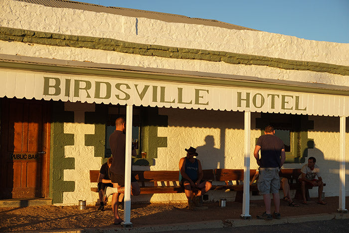 Image courtesy of NomadicPics via flickr
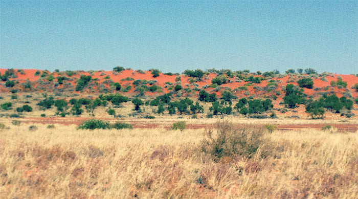 Image courtesy of Joy Engelman Wikimedia Commons
Frequently Asked Questions about the Birdsville Track
Where does the Birdsville Track start and finish?
The Birdsville track starts in Marree (650 km north of Adelaide) and finishes in Birdsville in south west Queensland.How long does the Birdsville Track take?
You can drive the 517 km of the Birdsville track in two days, although many people prefer to take their time and stop along the way.Is the Birdsville Track suitable for caravans?
Many people report successfully taking their caravan or camper trailer on the Birdsville Track. Keep in mind that it’s an unsealed road and that conditions vary during the year. Make sure all items in your caravan are well secured and carry two spare tyres because the trip can be rough and bumpy. Image courtesy of Ian Cochrane via flickr
Maps and Guides
Before you head off be sure to pick up a copy of the Birdsville Track Outback Travellers Guide with more information, GPS coordinates and maps including track hazards. If you're going to be doing the Strzelecki track, make sure to read our guide here). Otherwise a couple of Hema maps cover the track in pretty good detail, either Central Australia or the Great Desert Tracks Eastern Sheet. Looking for more information? Give our friendly and knowledgeable team at The Chart & Map Shop a call on (08) 9335 8665 or you can get in touch with us online.Featured collection
Categories:
4WD
Australia
Posted on: Jun 24, 2020



Comments
Patricia
Feb 1, 2023Is the Big Red sand dune an essential part of the east to west journey ? Which parts are the most challenging for a 1996 raised Jeep cherokee at 289,000 km, and a 79 year old driver.
I have crossed a number of outback NSW dirt road journeys eg Coonamble, but have always want to drive to Birdsville. A sunset journey you might say.